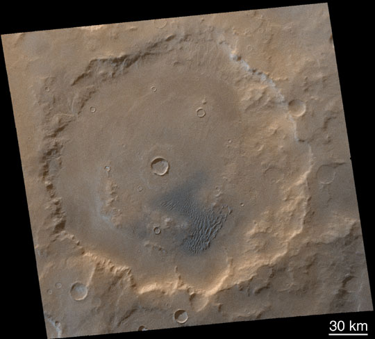
| Kaiser Crater
As the Mars Global Surveyor Primary Mission draws to an end, the
southern hemisphere of Mars is in the depths of winter. At high latitudes,
it is dark most, if not all, of the day. Even at middle latitudes, the sun
shines only thinly through a veil of water and carbon dioxide ice clouds,
and the ground is so cold that carbon dioxide frosts have formed. Kaiser
Crater (47°S, 340°W) is one such place. At a latitude
comparable to Seattle, Washington, Duluth, Minnesota, or Helena,
Montana, Kaiser Crater is studied primarily because of the sand dune
field found within the confines of its walls (lower center of the Mars
Orbiter Camera image, above). The normally dark-gray or blue-black
sand can be seen in this image to be shaded with light-toned frost.
Other parts of the crater are also frosted. Kaiser Crater and its dunes
were the subject of an earlier presentation of results. Close-up pictures
of these and other dunes in the region show details of their
snow-cover, including small avalanches. The two Mars Global Surveyor
Mars Orbiter Camera images that comprise this color view (M23-01751
and M23-01752) were acquired on January 26, 2001.
Photo Credit: NASA/JPL/Malin Space Science Systems
|