Where is Perseverance?

DAYS
ON MARS

Embed Perseverance's location map by pasting the following code into your website. By using the code and embedding this resource, you consent to Multimedia Policy.

<iframe src='https://mars.nasa.gov/maps/location/?mission=M20&site=NOW' width='800' height='450' scrolling='no' frameborder='0' allowfullscreen></iframe>


Perseverance Rover Location: This interactive map shows the landing site for NASA's Perseverance rover within Jezero Crater. Perseverance landed on Feb. 18, 2021. The map also shows the location of the Mars Helicopter.
View full experience | Using the map tools | Embed map

Zooming In and Out

Zoom out to enjoy an overview of the journey so far, or zoom in to dig deeper at each stop along the way. The scale bar (in meters), in the lower left corner of the map will change as you zoom in and out. As will the latitude and longitude to note your location on the lower right corner. The plus and minus symbols on the top right corner will also allow you to zoom in and out.


Top Panel: Sols and Distance

Along the top edge of the map, you can see the driving Sols on Mars. Sometimes there are several days (Sols) worth of interesting science to do in one spot before moving on.

The total distance is recorded in kilometers and in miles and is updated every time the rover drives.


Left Panel: Layers Layers Icon

Use the layers tool on the left side-bar to select or deselect the color base map, location labels, path or waypoints. Use the sliders to the left to adjust the color and contrast of the base map.


Left Panel: Pin Pin Icon

Select sites to explore by clicking the pin icon. View a list of the major areas in Jezero Carter that Perseverance has visited. Click on the name to go directly to that location.


Left Panel Bottom: Screen Shot Screen shot Icon

The camera icon allows you to take a screenshot of a location and automatically download it from the site.


About This Map

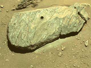
Scroll and pan around this map to see the latest location and traverse path for the Mars Perseverance rover at Jezero Crater. The goal of the mission is to seek signs of ancient life and collect samples of rock and regolith (broken rock and dust) for possible return to Earth.

This map is composed of two layers: a high-resolution color map covering the initial exploration area inside Jezero Crater, and another true-color Northeast Syrtis regional map. The high-resolution base map was created with images from the HiRISE camera on NASA’s Mars Reconnaissance Orbiter, while the broader color base map is from the European Space Agency Mars Express High Resolution Stereo camera (the original image can be found here). Some color processing has been applied to both maps to highlight surface features. A high-resolution Digital Elevation Model was created from the images to provide critical information for rover drivers, who need to know how steep the hills are as they plan a path forward through this rocky terrain.

Engineers created this experience with software used by the mission team who decide where Perseverance will explore, and how to get there. Each dot represents the end point of a drive and is labeled with the day, or sol, on Mars, that the rover stopped.