15-DEC-2004 10:00 AM PST
December 2003 MGS MOC Image Releases
November 2003 MGS MOC Image Releases
October 2003 MGS MOC Image Releases
10,232 New MOC Images From August 2002 through February 2003 Released!
September 2003 MGS MOC Image Releases
First MOC Public Requested Image: Caldera of Pavonis Mons
NEW FINDINGS COULD DASH HOPES FOR PAST OCEANS ON MARS
MSSS Release: NASA ORBITER EYES PHOBOS OVER MARS HORIZON
The following new images taken by the Mars Orbiter Camera (MOC)
on the Mars Global Surveyor spacecraft are now available:
Cycloidal Dust Devil Track (Released 05 June 2003)
http://www.msss.com/mars_images/moc/2003/06/05/index.html
Terrain Near Gordii Dorsum (Released 06 June 2003)
http://www.msss.com/mars_images/moc/2003/06/06/index.html
South Polar Cap in Summer (Released 07 June 2003)
http://www.msss.com/mars_images/moc/2003/06/07/index.html
Layers in Galle Crater (Released 08 June 2003)
http://www.msss.com/mars_images/moc/2003/06/08/index.html
Tractus Catena Collapse Pits (Released 09 June 2003)
http://www.msss.com/mars_images/moc/2003/06/09/index.html
Frost in Charitum Montes (Released 10 June 2003)
http://www.msss.com/mars_images/moc/2003/06/10/index.html
Gullies in Crater Wall (Released 11 June 2003)
http://www.msss.com/mars_images/moc/2003/06/11/index.html
22-MAY-2003 5:00 PM PST
PIA04531: Earth and Moon as viewed from Mars
MSSS Earth ,Moon, & Jupiter Images
MSSS -- MOC2-325 to MOC2-330 -- New High Resolution and Global Views of Mars
07-MAR-2003 5:00 PM PST
12-DEC-2002 3:00 PM PST
MSSS -- MOC2-321 to MOC2-324 -- Start of 3rd Mars Year
18,812 New MGS MOC Images (E07-E12) Archived and Online
23-SEP-2002 3:00 PM PST
MSSS Release -- MOC2-316 to MOC2-319 Solar Conjunction Sampler
MSSS Image Releases
MOC2-315 High latitude Polygons
MSSS Image Releases
MSSS Image Releases
MOC2-300 to MOC2-304 -- 1 Yr of Extended Mission
Mars Atlas Revisited: The MGS MOC Wide Angle Map of Mars
MOLA - Seasonal Variations of Snow Depth on Mars
High-Resolution Shaded Relief Quadrangle Maps of Mars
Initial Results from MOLA Passive Radiometry
MSSS Release - MOC2-298 South Polar Cap
MSSS Release - MOC2-297 Climate Change
MSSS Release - MOC2-296 100,000th Image
MSSS Release -- MOC2-295 Ganges Landslide
MSSS Release -- MOC2-294 Herschel Dunes
MSSS Release -- MOC2-293 Utopia Pits
MSSS Release -- MOC2-292 Schiaparelli Layers
MSSS Release -- MOC2-290 Global Dust Event
MSSS Release -- MOC2-291 Global Dust SSU
M19-M23: 10,000 New MOC Images
28-SEP-2001 4:00 PM PDT
MSSS Release -- MOC2-288 Big Dust Storm
MSSS Release -- MOC2-289 South Polar Cap
Preprint of upcoming MGS MOC paper for the Journal of Geophysical
Research
Special
Issue on the results of Mars Global Surveyor
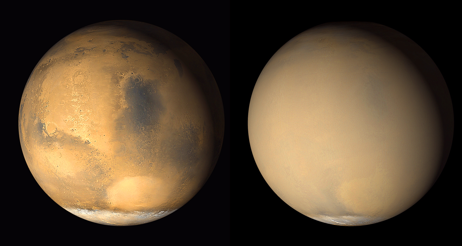
DUST STORM SWALLOWS HALF OF MARS
06-JUL-2001 5:00 PM PDT
22-JUN-2001 5:00 PM PDT
15-JUN-2001 3:00 PM PDT
13-JUN-2001 11:00 AM PDT
MSSS Images - Mars Opposition and Equinox
MOC2-285 -- Mars Opposition/Equinox
MSSS Release -- MOC2-280 to MOC2-284 Extended Mission Images
MOC Images of Cydonia Region Released by MSSS
TES Broadband Visible and Near-Infrared Reflectance
TES Daily Temperature Profiles of the Surface of Mars
Regional closeups of Martian topography
The enigmatic northern plains of Mars
Horizon Science Experiment (HORSE)
05-APR-2001 4:00 PM PDT
M13-M18: 10,230 New MOC Images
MOLA -- Ancient Geodynamics and Global-scale Hydrology on Mars
Updated History of Orbital Parameters
MSSS Release - MOC2-279 - Red Rover Student Images
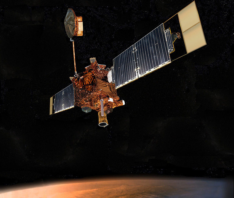
Today, NASA celebrates its highly successful Mars Global Surveyor mission, which has collected more information about the red planet than all previous missions combined. Mars Global Surveyor will complete its primary mission at 4:33:22 p.m. (PT) on January 31, 2001.
The spacecraft will immediately move into an extended mission phase, continuing to study the planet's topography, seasonal changes, and internal and atmospheric structures.
MSSS Release -- MOC2-269 to MOC2-278
Mars Global Surveyor Mission Status - X-axis reaction wheel
New Science Results from MOLA
MOLA Observations of Snow and Clouds
National Geographic map of Mars using MGS MOLA and MOC data
A high-resolution global shade map
Tharsis/Chryse image, as published in the February 2001 issue of Sky and Telescope
MOLA map with major surface features labeled
Top 10 Scientific Achievements from MOLA
MSSS Release -- MOC2-267 Beagle 2 Site--Part 1
MSSS Release -- MOC2-268 Beagle 2 Site--Part 2
MSSS Release -- MOC2-266 Polar Icecaps
MOC Images Suggest Early Mars History is Recorded in Sedimentary Rocks
MSSS Release -- MOC2-259 to MOC2-265
MAJOR MARS DISCOVERY TO BE ANNOUNCED AT DEC. 7 SCIENCE BRIEFING
MSSS Release -- MOC2-258 Frosted Craters
MSSS Release -- MOC2-257 Autumn in Hale
New publication-quality global and polar shaded relief images from MOLA
MOLA Data Product Archives - New global topographic grid with resolution
MSSS Release -- MOC2-256 3-D Wind Erosion
New High Resolution Data from MOLA
Major Martian Volcanoes from MOLA
MOLA Views of Valles Marineris
MSSS Release - Over 57,500 New Images!
MSSS Release - MOC2-250 Valleys E of Hellas
MSSS Release -- MOC2-249 Mars/Earth Dust Storms
MSSS Release - MOC2-248 Sirenum Trough August 2000
MSSS Release - MOC2-247 N Polar Dunes
MOC Returns to Service Following Solar Conjunction Hiatus
MSSS Finds Evidence of Flowing Water on Mars
For the next three weeks MGS will be in solar
conjunction. During this time we will not be receiving
telemetry from the spacecraft. See the Current
Postion of Earth and Mars for more details.
MSSS - Latest MGS Images from Mars Orbit - Over 25,000 New Images
New animations of TES broadband visible and near-infrared reflectance
MSSS - Olympus Summit - MOC2-224
MOLA -- Regional Views of Martian Topography from the first year of MGS Global Topographic Mapping
MSSS - MOC2-222 -- All Cydonia Images
16-MAR-2000 12:30 PM PST
13-MAR-2000 11:00 AM PST
Mars Global Surveyor Reveals the Internal Structure of Mars
GSFC - VIEW INSIDE MARS REVEALS RAPID COOLING AND BURIED CHANNELS
Volcanic compositions of much of the Martian surface
MSSS - The Martian Polar Caps - MOC2-210 to MOC2-219
New publication-resolution color shade maps from MOLA
11-FEB-2000 5:00 PM PST
Real Time Ground Track of MGS Over the Surface of Mars
Improved Version - Position of Spacecraft in Relation to Mars During Telemetry Playback
We have improved the simulated view of Mars to yield crisper images and faster loading. In order to display more mission data, we will be adding additional real time pages to the site over the coming weeks.
Coming Soon: Real Time Ground Tracks of MGS Over the Surface of Mars
Updated Aerobraking Orbital Parameters
USGS - New Release of MGS MOC Images
12-JAN-2000 4:00 PM PST
The MGS site is now a primary area of focus. The home page and content will be changing as we add more dynamic information.