3 min read

It was just a few short weeks ago that we acquired sample from the “Mary Anning” drill target. In those intervening weeks, CheMin, SAM, ChemCam, APXS and MAHLI have all thoroughly investigated the resulting sample and drill hole, and found it compelling enough that we are ready to dig into the bedrock in our workspace again. Today’s plan focused on analyzing the "Mary Anning 2” drill target, but we had enough time to fit in other observations as well.
MAHLI will start the fun by imaging the second Mary Anning target before the DRT brushes it to hopefully better resolve the laser spots from when ChemCam shot the target on Sol 2831. After DRT brushing, MAHLI will image the target again to give APXS a look at the newly-cleaned place it will analyze. Next, the rover engineers will push the drill bit into the target to see how the rock responds ahead of drilling. MAHLI will image the target yet again to see what kind of impression, if any, the drill bit made in the rock. APXS has its chance to acquire data from within the DRT-cleaned area overnight on Sol 2858. CheMin will also be getting ready for the next Mary Anning sample by running an analysis of the empty cell that is waiting to receive the sample.
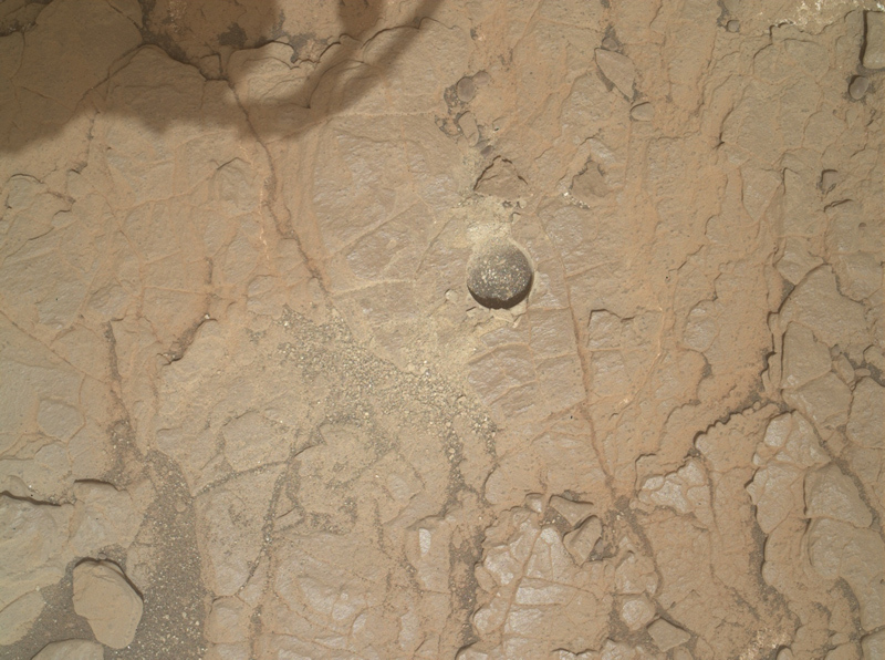
With all this arm activity right in front of the rover, ChemCam selected a target off to rover right called “Falkirk Wheel.” Falkirk Wheel appears to be another collection of dark nodules like the “Ayton” target analyzed by ChemCam, MAHLI, and APXS in previous plans. Comparing and contrasting these targets will hopefully help us understand more about their origin. The MAHLI image above of the first Mary Anning drill hole, which shows the disappearance of the drill tailings around the hole, makes it abundantly clear that winds are moving material around. Both Mastcam and MARDI will acquire images aimed at tracking these wind-induced changes. Mastcam will image a patch of ripples at the “Skelmorlie” target for comparison to previous images of that area. MARDI will image three times - twice in the early evening and once early in the morning - to figure out when the winds are at their strongest. Are the winds kicking up dust devils? Navcam will acquire a movie to look for them! REMS, RAD, and DAN dot the plan keeping their regular eyes on the state of the environment above and below the rover.
Written by Michelle Minitti, Planetary Geologist at Framework


