3 min read

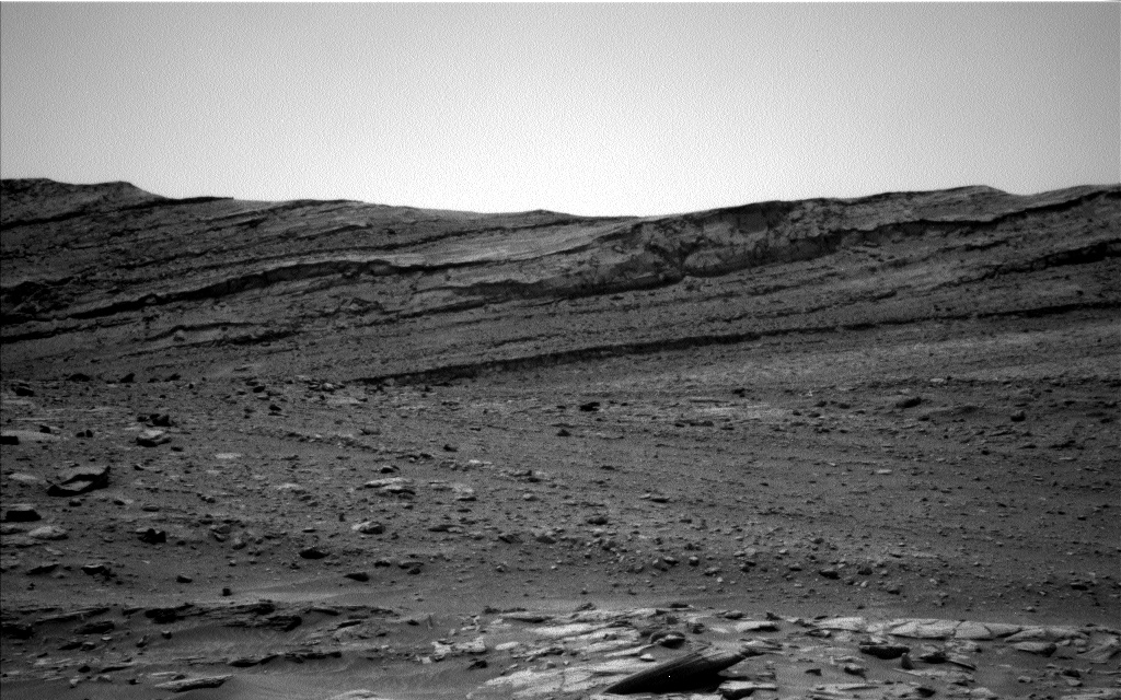
We have left the pediment behind and are making our way back to an alternate “MSAR” or “Mount Sharp Ascent Route.” We are at the second (of three) observation stops for this area, chosen as they offer the best chance to acquire high resolution images of the structures in the buttes. We have noticed some dark layers which are reminiscent of the lenses at “The Prow” and may indicate changing grain sizes or depositional environments. In an ideal world, we geologists would just climb up the side of a given butte to thoroughly investigate the layer but sadly, we are not going to be able to walk… or drive the rover… up the side of these buttes, so Mastcam is taking a large (132 frame) mosaic of the “Maringma” butte here at this vantage point.
ChemCam is also acquiring a long distance RMI (remote image) of “Tweedbank,” which is one of these dark layers.
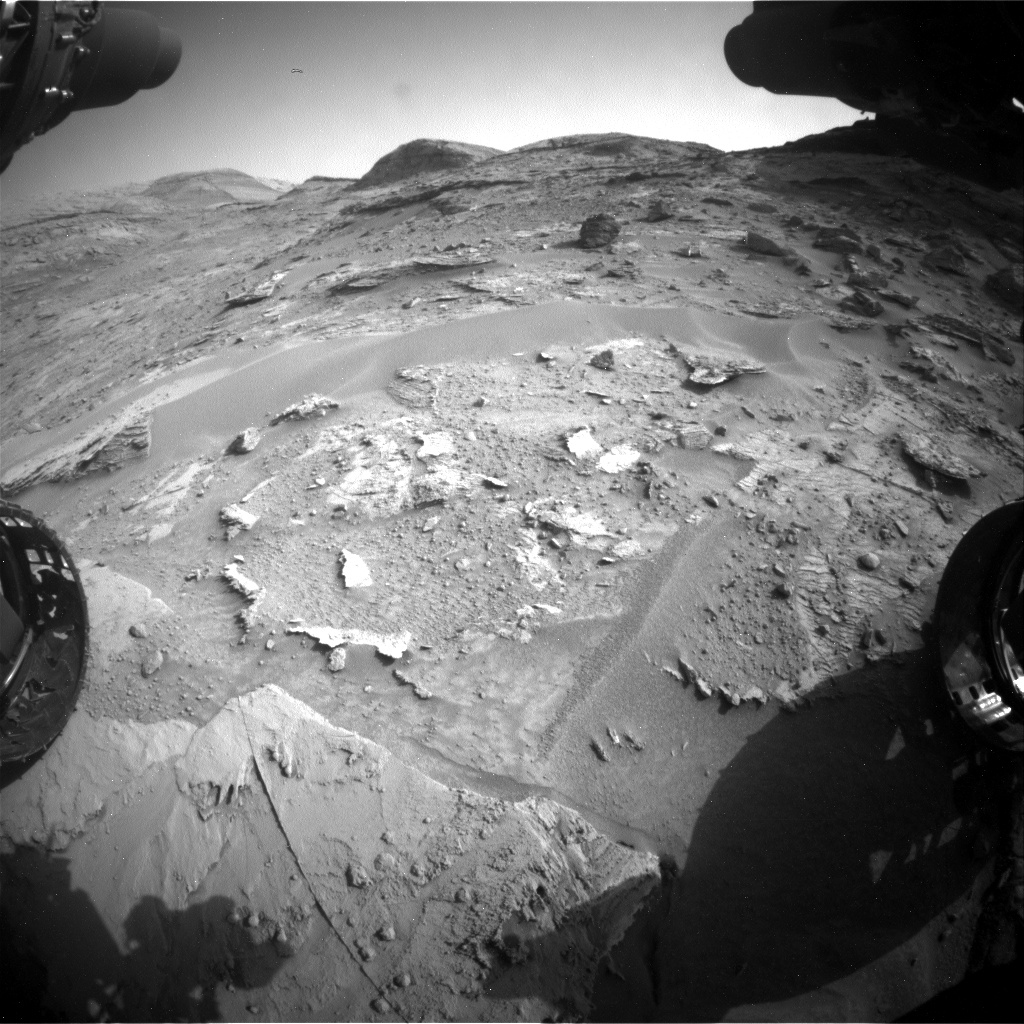
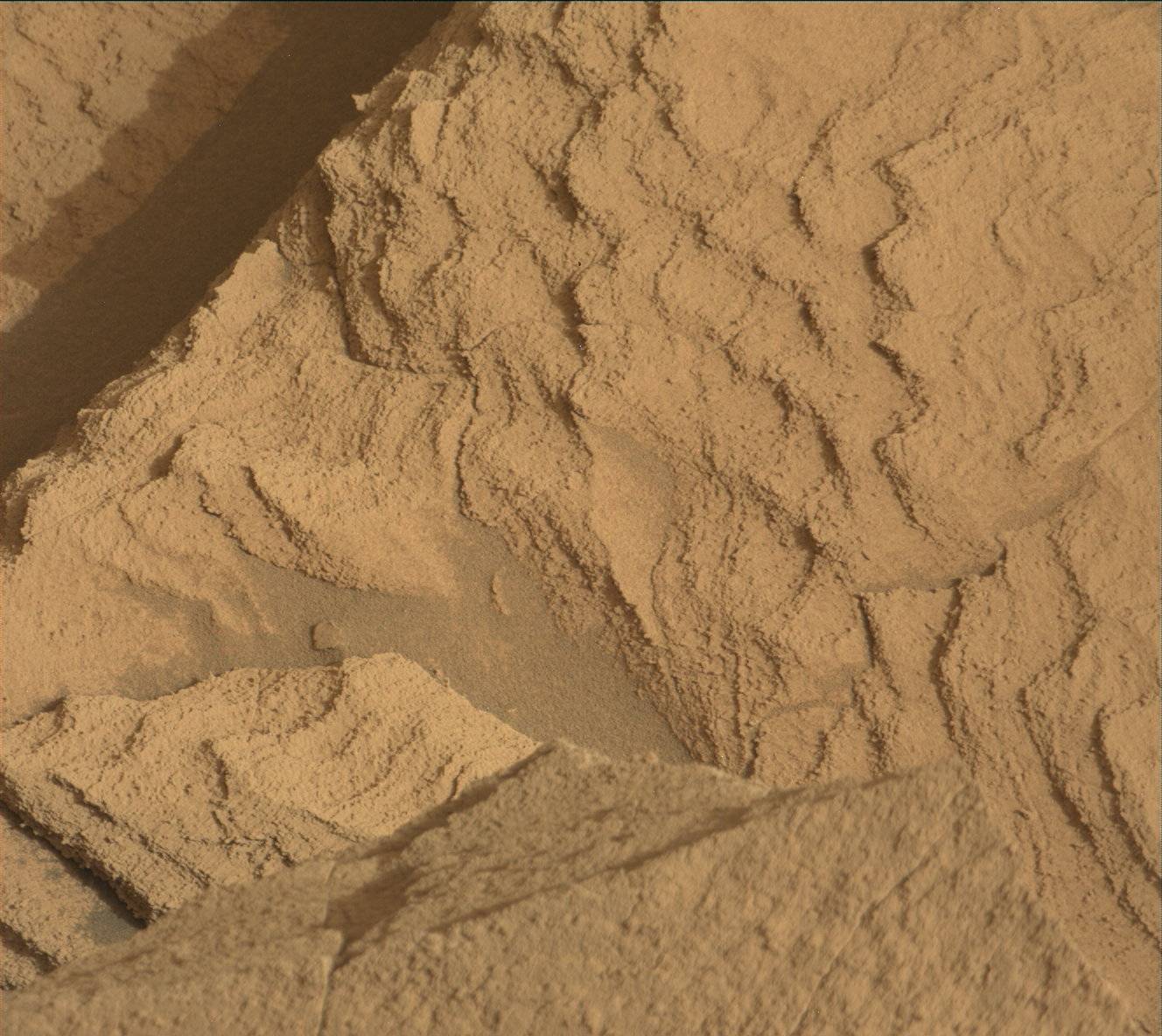
Although we are surrounded by large buttes and rocky hills, our reachable workspace (basically the centre on the above image, in between the two wheels and upwards) was pretty low on rocks this morning! Fortunately, there are small fragments peeking out from under the sand and dust cover, so APXS and MAHLI were able to get two targets close to each other (on the centre right of the image, looking like a book which has fallen open). “Castlecraig” is a tilted fragment, with a brighter appearance than surrounding rocks. These targets are often veins (of calcium sulphate) and we like to analyze these periodically, as veins can reveal hints about conditions at the time of deposition or later. The second target “Cat Firth” is on more regular bedrock. Unfortunately, this target is too small to brush off the sand and dirt. However, it appears to be relatively clean, so hopefully will provide good quality APXS measurements on bedrock, so that we can document changes in base bedrock composition too. Mastcam is also imaging some fine laminations in the target “Moorhowe” which is in the workspace but out of reach of the arm.
As always, ENV is continuing to monitor atmospheric opacity and dust levels. On the first night of the plan, we also have an APXS environmental measurement, to monitor argon levels in the atmosphere which change with the seasons.
Once all the contact science and imaging are done here, we continue with our drive which is planned to take us to the third observation point, which is actually in the next naming quad – so in this drive, we will say “Mar sin leat” (goodbye in Scots Gaelic) to the Torridon quad and “Olá” (hello in Portuguese) to the “Roriama” quad.
Written by Catherine O'Connell-Cooper, Planetary Geologist at University of New Brunswick


