MISSION UPDATES | October 31, 2022
Sols 3637-3638: Let the Detour Begin – To Gediz Vallis Ridge We Go!
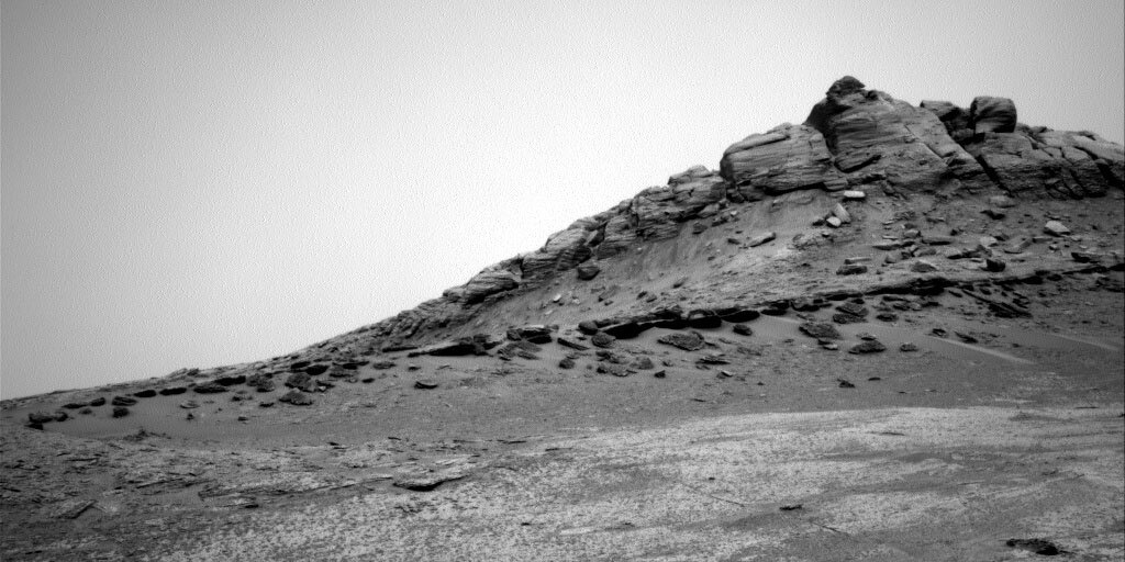
Right navigation camera, showing the Marker Band as a continuous dark thin layer running from left to right (but thinning out on the left). Credits: NASA/JPL-Caltech. Download image ›
This is a two sol weekend plan, as Saturday is a soliday. On the first sol, we characterize the workspace in front of us and then drive on the second sol to a new workspace. We are now officially on our detour, a short round trip to image and capture geochemistry of the “Gediz Vallis ridge” up on the pediment, before coming back down to the “Marker Band valley” and rejoining the MSAR (Mount Sharp Ascent Route). This detour will allow us to access some of the area we’d planned to visit before getting turned around by the ‘gator-back’ terrain on the Greenheugh pediment. For this part of the campaign, we are prioritizing driving, getting to our destination as fast as we can, but imaging as we go and marking areas of interest for contact science as we come back down. Today’s drive begins our ascent, taking us up a 16 degree slope to a ridge which will give us good views of the terrain ahead.
This drive also brings us closer to the contact with the Marker Band itself, a relatively thin band of material, traceable throughout this area (see accompanying image), but whose composition and origin are unclear. It may be in our workspace or just beyond after the weekend drive, so the end of drive imagery from the weekend plan will be very eagerly awaited. This imagery includes a very large Mastcam mosaic (48 images) along the potential contact with the Marker Band and some bedrock slabs which may be part of the Marker Band.
Before we drive, we first get as much information as possible from this location. The workspace had bedrock and abundant small grey pebbles or nodules, some of which were loose on the bedrock but some of which appeared to be in place. We managed to find a brushable bedrock spot for the first time since leaving the Canaima drill site, which helps APXS characterize the bedrock free of dust and sand. APXS will also analyze a cluster of the pebbles. MAHLI will image both the brushed bedrock (“Catrimani”) and the cluster (“Marari”) targets. A Mastcam multispectral image on Catrimani rounds out that set of observations. ChemCam is using LIBS to analyze a nodular feature (“Cumate”), a layer of more resistant material (“Wai Wai”) and some more typical bedrock (“Au Au” or “Gold Gold” as we nicknamed it). Mastcam will image both ChemCam targets.
Mastcam will also take several larger images of material just beyond the workspace. “Iniquiare” captures a set of large fractures. “Linepenome” is a set of three images centred on a large float block and the sorting of sands around this feature.
We also continue our environmental monitoring. Mastcam is acquiring a pair of tau measurements and a sky survey to monitor dust levels. REMS and DAN will compliment these with their usual cadence of temperature checks (REMS) and routine hydrogen checks (DAN).