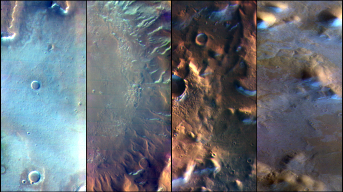
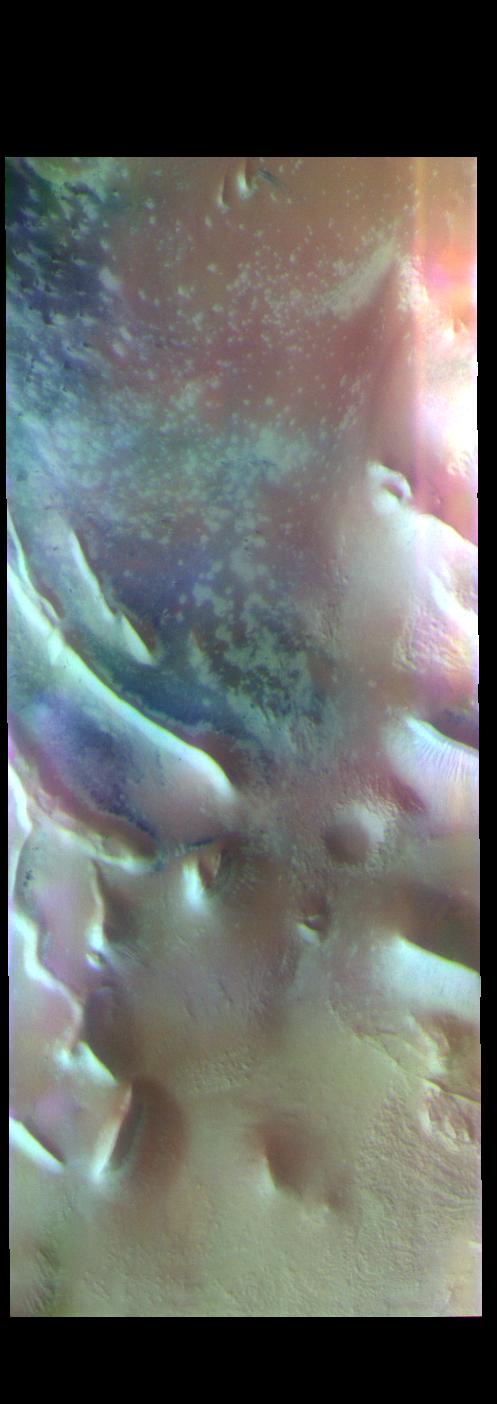
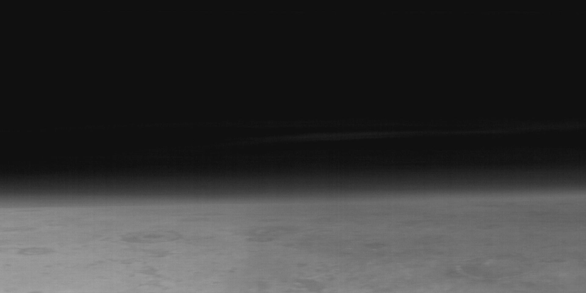
This image from NASAs Mars Odyssey shows part of Terra Sirenum.
April 16, 2021
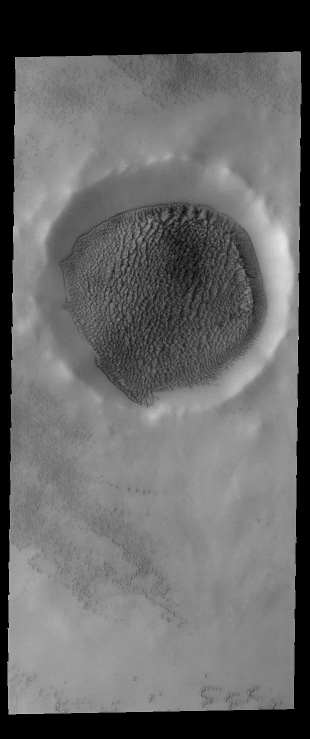
This image from NASAs Mars Odyssey shows the floor of an unnamed crater in Terra Sirenum.
April 15, 2021
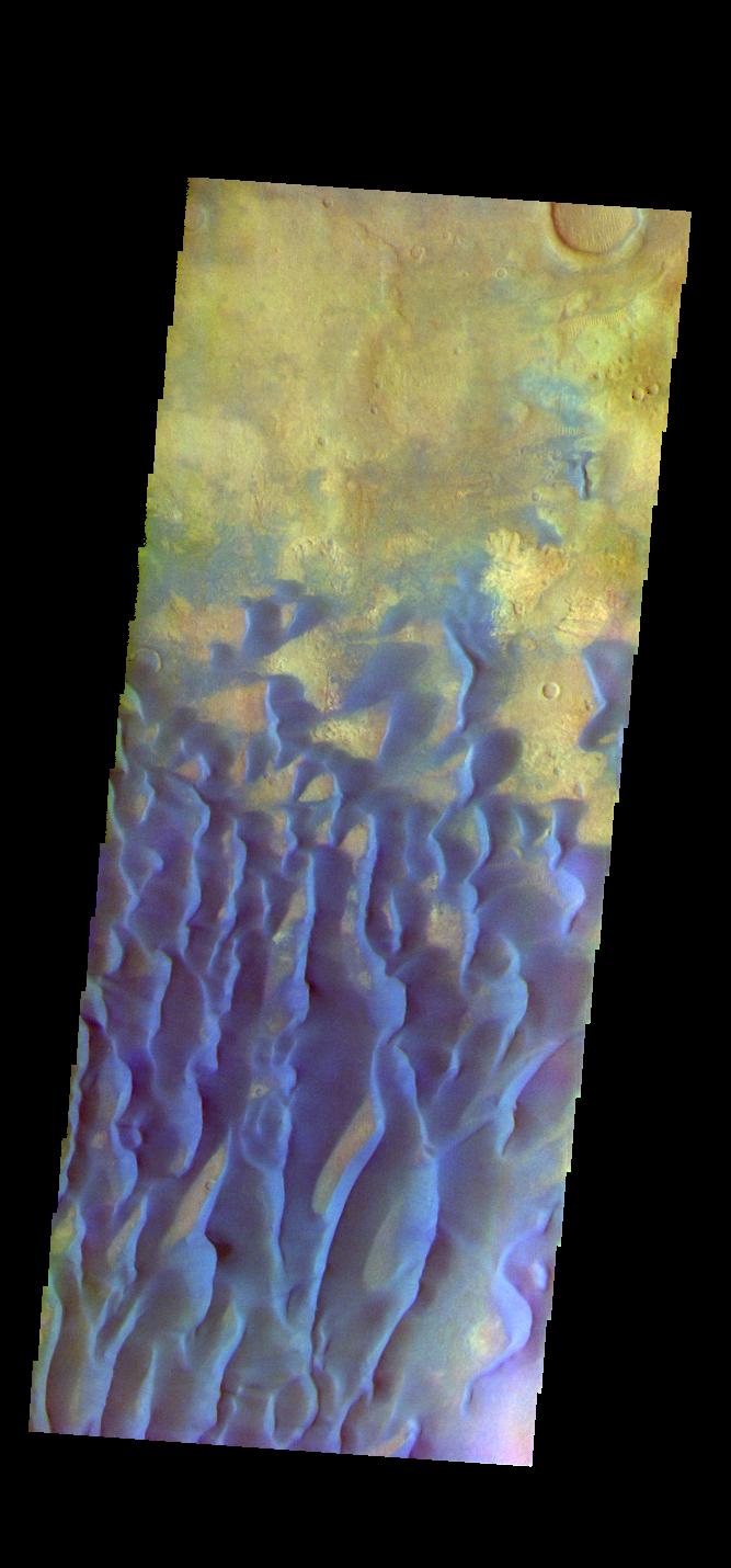
This image from NASAs Mars Odyssey shows the floor of an unnamed crater in Noachis Terra.
April 14, 2021
This image from NASAs Mars Odyssey shows part of Terra Cimmeria.
April 13, 2021
This image from NASAs Mars Odyssey shows part of Australe Mensa, part of the south polar ice cap.
April 12, 2021
This image from NASAs Mars Odyssey shows part of Angustus Labyrinthus, a unique region near the south polar cap.
April 9, 2021
This image from NASAs Mars Odyssey shows the region where Mawrth Vallis enters Acidalia Planitia. The name Mawrth Vallis comes from the Welsh word for Mars.
April 8, 2021
This image from NASAs Mars Odyssey shows part of the rim of Holden Crater. Located in Noachis Terra, Holden Crater is 152km (94 miles) in diameter.
April 7, 2021
This image from NASAs Mars Odyssey shows part of the floor of Herschel Crater. Several regions of sand dunes are visible.
April 6, 2021
This image from NASAs Mars Odyssey shows part of Thaumasia Planum.
April 5, 2021
This image from NASAs Mars Odyssey shows part of Margaritifer Terra. The linear depressions were created by extensional tectonic stresses.
April 2, 2021
This image from NASAs Mars Odyssey shows the floor of an unnamed crater in Tyrrhena Terra. Sand dunes are visible on the crater floor. Dark blue tones indicate basaltic sands.
April 1, 2021
This image from NASAs Mars Odyssey shows part of Daedalia Planum. The pale blue surfaces are thought to be early morning ground frost.
March 31, 2021
This image from NASAs Mars Odyssey shows the floor of Peridier Crater. Small dunes are visible in the image. Dark blue tones indicate basaltic sands.
March 30, 2021
This image from NASAs Mars Odyssey shows Trouvelot Crater and other nearby craters. Dark blue tones in this version of color combination is often dark basaltic sands.
March 29, 2021
This image from NASAs Mars Odyssey shows part of Dawes Crater. Dawes Crater is located in Terra Sabaea and is 185 km (115 miles) in diameter.
March 26, 2021
This image from NASAs Mars Odyssey shows a cross section of Gale Crater, including the large layered deposit in the center of the crater.
March 25, 2021
This image from NASAs Mars Odyssey shows part of Candor Chasma. Candor Chasma is one of the largest canyons that make up Valles Marineris.
March 24, 2021
This image from NASAs Mars Odyssey shows the channel floor of Mawrth Vallis.
March 23, 2021
This image from NASAs Mars Odyssey shows part of Noachis Terra.
March 22, 2021
This image from NASAs Mars Odyssey shows an unnamed crater in Noachis Terra. Dark blue tones in this filter combination indicate basaltic sands.
March 19, 2021
This image from NASAs Mars Odyssey shows part of Ganges Chasma. Ganges Chasma is part of the Valles Marineris chasma system, but is north of the main section of canyons.
March 18, 2021
This image from NASAs Mars Odyssey shows a cross section of Trouvelot Crater and the smaller unnamed crater on its floor.
March 17, 2021
This image from NASAs Mars Odyssey shows a small section of Hydaspis Chaos, one of many regions of chaos in Margaritifer Terra.
March 16, 2021
This image from NASAs Mars Odyssey shows a small section of Cydonia Colles, a group of hills located in southeastern Acidalia Planitia.
March 12, 2021
This image from NASAs Mars Odyssey shows several craters in northwestern Arabia Terra.
March 11, 2021
This image from NASAs Mars Odyssey shows part of the floor of Schroeter Crater.
March 10, 2021
This image from NASAs Mars Odyssey shows several craters located in Terra Cimmeria.
March 9, 2021
This image from NASAs Mars Odyssey shows part of Nili Fossae. The linear depressions crossing the center of the image are graben.
March 8, 2021
This image from NASAs Mars Odyssey shows a cross section of Hebes Chasma. Hebes Chasma is a closed basin located north of Valles Marineris.
March 5, 2021
This image from NASAs Mars Odyssey shows part of the floor of an unnamed crater located in Arabia Terra, near the boundary with Acidalia Planitia.
March 4, 2021
This image from NASAs Mars Odyssey shows sand dunes on the floor of an unnamed crater in Terra Cimmeria. Dark blue in this filter combination indicates basaltic sand.
March 3, 2021
This image from NASAs Mars Odyssey shows a small section of Nili Fossae. The linear depression at the top of the image is one of the Nili Fossae graben.
March 2, 2021
This image from NASAs Mars Odyssey shows a crater in Arabia Terra. Dark blue in this filter combination indicates basaltic sand.
March 1, 2021
This image from NASAs Mars Odyssey shows sand sheets in two unnamed craters located in Noachis Terra.
February 25, 2021
This image from NASAs Mars Odyssey shows part of Angustus Labyrinthus. Angustus Labyrinthus is a unique region near the south polar cap.
February 23, 2021
This image from NASAs Mars Odyssey shows a small section of Mangala Valles. Mangala Valles is a complex channel more than 900km long (560 miles).
February 22, 2021
This image from NASAs Mars Odyssey shows an unnamed crater located on the margin of the south polar cap.
February 19, 2021
This image from NASAs Mars Odyssey shows Promethei Chasma, part of the South Pole.
February 18, 2021
This image from NASAs Mars Odyssey shows Angustus Labyrinthus. The squares formed by intersecting ridges earned the feature the informal name of the Inca City when it was discovered in Mariner 9 images in 1972.
February 17, 2021
This image from NASAs Mars Odyssey shows Angustus Labyrinthus, a unique region near the south polar cap.
February 16, 2021
This image from NASAs Mars Odyssey shows part of McMurdo Crater. Located on the margin of the south polar cap, the layering of the ice is visible along the crater rim.
February 12, 2021
This image from NASAs Mars Odyssey crosses both Ophir Chasma and Candor Chasma. Layered and eroded material covers the floors of both chasmata. Both canyons are part of Valles Marineris.
February 11, 2021
This image from NASAs Mars Odyssey shows Claritas Fossae, a graben filled highland located between the lava plains of Daedalia Planum and Solis Planum.
February 10, 2021
This image from NASAs Mars Odyssey shows Claritas Fossae, a graben filled highland located between the lava plains of Daedalia Planum and Solis Planum.
February 9, 2021
This image from NASAs Mars Odyssey shows an unusual layer of smooth material covers the flanks of the volcano Peneus Patera just south of the Hellas Basin.
February 8, 2021
This image from NASAs Mars Odyssey shows an unusual layer of smooth material covering the flanks of the volcano Peneus Patera just south of the Hellas Basin.
February 5, 2021
This image from NASAs Mars Odyssey shows part of Richardson Crater. A large sand sheets covers the floor of the crater.
February 4, 2021
This image from NASAs Mars Odyssey shows a linear depression, part of Sirenum Fossae. Depressions of this type are called graben, which form by the down drop of material between two parallel faults.
February 3, 2021
This image from NASAs Mars Odyssey shows part of Richardson Crater. A large sand sheet covers most of the floor of the crater.
February 2, 2021