Images
Martian 'Perseverance Valley' in Perspective (Vertical Exaggeration)
February 15, 2018
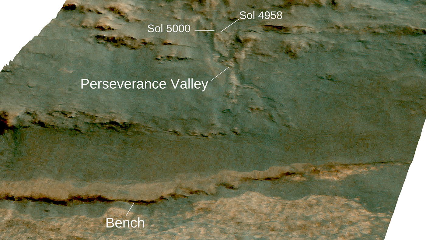
The channel descending a Martian slope in this perspective view is "Perseverance Valley," which is the study area of NASA's Mars Exploration Rover Opportunity as the rover passes its 5,000th sol, or Martian day, of its mission on the surface of Mars.
The view was produced by overlaying an image take from orbit onto a topographic model with five-fold vertical exaggeration to emphasize the shapes on the rim of a large crater that have been cut by the valley on the inboard slope of the rim. The image used is from the High Resolution Imaging Science Experiment (HiRISE) camera on NASA's Mars Reconnaissance Orbiter, observation ESP_036753_1775.
The crest of a portion of the western rim of Endeavour Crater is at the top of the view, and the floor of the crater is in the foreground, below an erosion-resistant bench perched beneath the valley. The crater is about 14 miles (22 kilometers) in diameter. This perspective view is from within the crater, looking westward. It spans an area about a quarter mile (400 meters) wide from left to right (south to north). The interior rim slopes about 15 to 20 degrees.
Figure 1 is an annotated version indicating Perseverance Valley and the bench, plus Opportunity's locations on Sol 5,000 (Feb. 16, 2018) and on Sol 4,958 (Jan. 4, 2018). On Sol 4958, the rover took images with its Navigation Camera and its Hazard Avoidance Camera showing textures of possible stone stripes. The graphic was created at Washington University in St. Louis.
A map of a slightly larger portion of the crater rim shows the location of Perseverance Valley and Opportunity's 2017 approach path. As of its Sol 5,000, Opportunity has driven 28 miles (45 kilometers) since its January 2004 landing, in what was planned as a 90-sol mission.
Credits
NASA/JPL-Caltech/Univ. of Arizona/WUSTL