Images
A Technicolor Mound near Oxia Planum
January 29, 2021
Map Projected Browse Image
Click on image for larger version
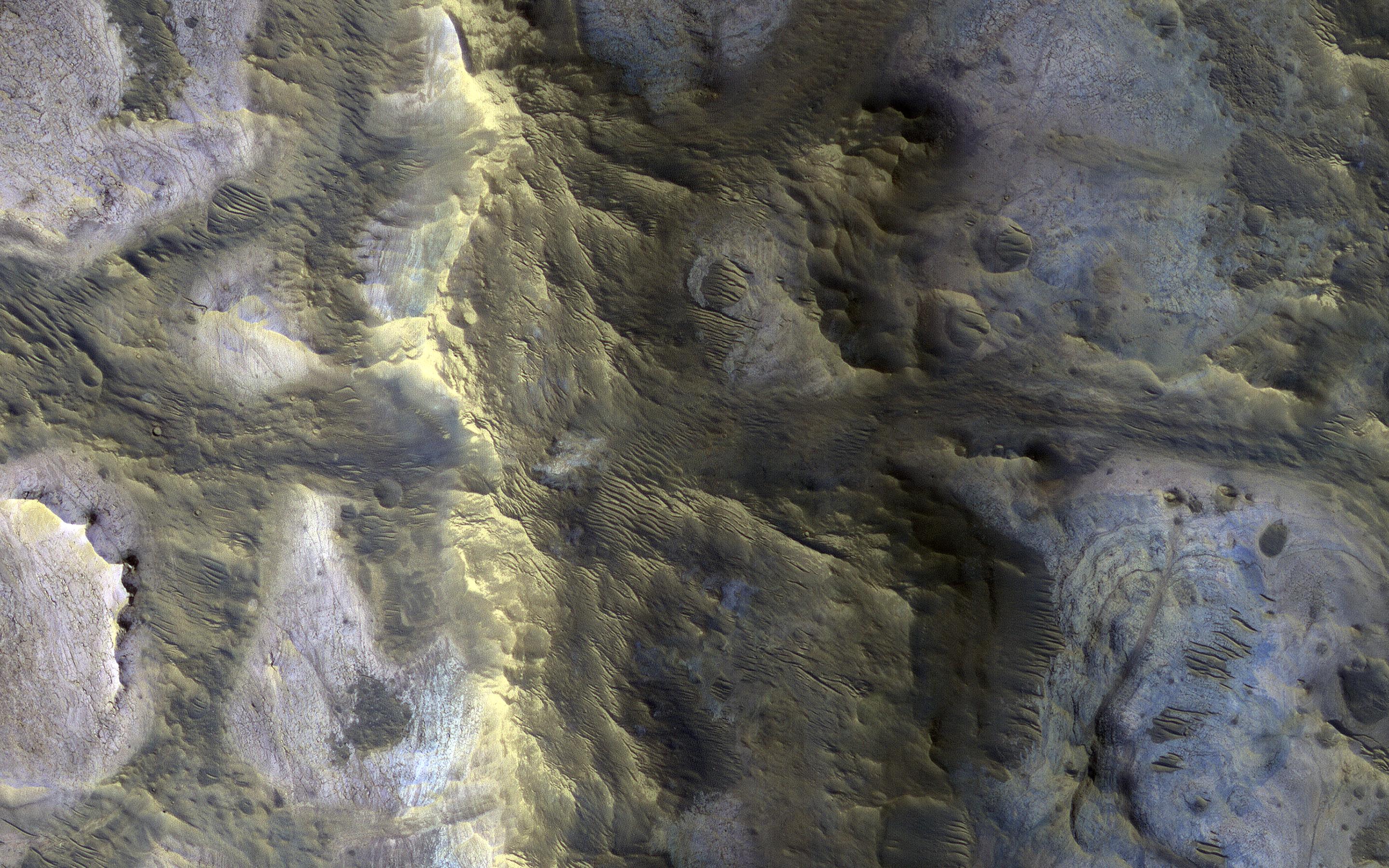
An isolated, elongated mound (about 1 mile wide and 3.75 miles long) rises above the smooth, surrounding plains. Horizontal layers are exposed at the northern end of the mound, and its surface is characterized by a very unusual quasi-circular pattern with varying colors that likely reflect diverse mineral compositions.
A closer view shows that the rock has a range of textures, from massive and fractured on the left, to subtle banding or layering on the right. The origin of this mound is unknown, but its formation may be related to the clay-bearing rocks in the nearby Oxia Planum region.
The map is projected here at a scale of 25 centimeters (9.8 inches) per pixel. (The original image scale is 28.5 centimeters [11.2 inches] per pixel [with 1 x 1 binning]; objects on the order of 85 centimeters [33.5 inches] across are resolved.) North is up.
The University of Arizona, in Tucson, operates HiRISE, which was built by Ball Aerospace & Technologies Corp., in Boulder, Colorado. NASA's Jet Propulsion Laboratory, a division of Caltech in Pasadena, California, manages the Mars Reconnaissance Orbiter Project for NASA's Science Mission Directorate, Washington.
Credits
NASA/JPL-Caltech/University of Arizona