More resources
Curiosity Mars Rover's Route from Landing to 'Pahrump Hills'
September 25, 2014
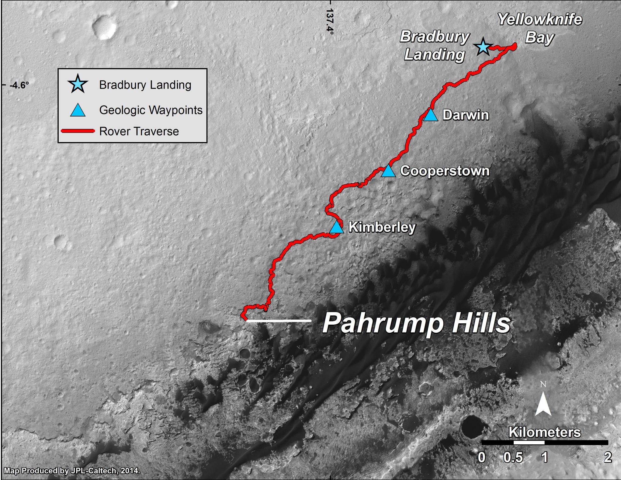
This map shows the route driven by NASA's Curiosity Mars rover from the "Bradbury Landing" location where it landed in August 2012 to the "Pahrump Hills" outcrop where it drilled into the lowest part of Mount Sharp. The rover reached Pahrump Hills with a 73-foot (22.4-meter) drive on the 653rd Martian day, or sol, of the rover's work on Mars (Sept. 19, 2014).
The base image for this map is from the High Resolution Imaging Science Experiment (HiRISE) camera on NASA's Mars Reconnaissance Orbiter. North is up. The dark ground south of the rover's route has dunes of dark, wind-blown material at the foot of Mount Sharp. The scale bar at lower right represents two kilometers (1.2 miles). For broader-context images of the area, see http://photojournal.jpl.nasa.gov/catalog/PIA17355 , http://photojournal.jpl.nasa.gov/catalog/PIA16064 and http://photojournal.jpl.nasa.gov/catalog/PIA16058.
NASA's Jet Propulsion Laboratory, a division of the California Institute of Technology, Pasadena, manages the Mars Science Laboratory Project and Mars Reconnaissance Orbiter Project for NASA's Science Mission Directorate, Washington.
